Where the World Begins – The Prime Meridian, the Antimeridian, and Greenwich Mean Time
Understanding where these lines came from, why they sit where they do, and what they actually mean is to understand something fundamental about how humanity agreed to share a planet.
There is nothing in the natural world that marks zero degrees longitude. No mountain spine runs north to south across the planet at that precise angle. No river, no reef, no geological fault says: here is where longitude starts. The Prime Meridian is a human invention, drawn through a particular courtyard in southeast London because, in 1884, the delegates of forty-one nations voted for it. The voting was not unanimous, and the reasoning behind the choice was less about science than about who already dominated the seas.
That single drawn line, and the equal-and-opposite line on the far side of the globe where it ends, now regulate the movement of every aircraft, every shipping container, every satellite, and every phone’s location service on earth. Understanding where these lines came from, why they sit where they do, and what they actually mean is to understand something fundamental about how humanity agreed to share a planet.
The Problem That Made Greenwich Famous
For most of recorded history, position at sea was one of the great unsolved problems of civilisation. Latitude, the measure of how far north or south a ship stood, was knowable. A navigator could sight the angle of the sun at noon, compare it against tables, and read off a latitude with reasonable precision. Longitude, the east-west measure, was a different matter entirely. There was no celestial body overhead that announced itself as sitting above the 30th meridian. A ship could sail for weeks under cloudy skies and have only its estimated speed and elapsed time to tell it how far it had come.
Ships sank because of this. Entire fleets miscalculated their position and drove onto rocks they could not see on charts that disagreed with one another. The British Parliament, in 1714, passed the Longitude Act and offered a prize of twenty thousand pounds, an enormous fortune, to anyone who could solve the problem with a method accurate to within thirty miles. The sum was never paid in full, but the contest it launched was one of the great scientific mobilisations of the eighteenth century.
Quote
“A ship could sail for weeks under cloudy skies and have only its estimated speed and elapsed time to tell it how far it had come.”
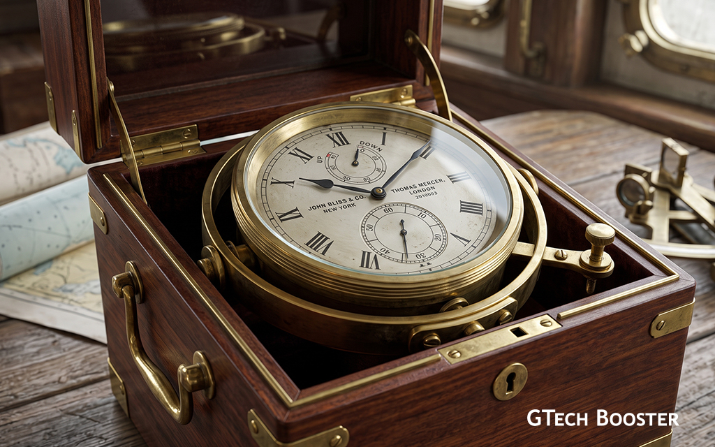
The solution, when it came, rested on time. If you knew precisely what time it was at a fixed reference point back home, and you could compare that to the local time at your current position (which you could calculate from the sun), the difference in hours told you your longitude. Each hour of difference corresponded to fifteen degrees of arc. The problem then became: how do you carry accurate time across months at sea on a wooden ship rolling through swells and temperature extremes?
John Harrison, a self-taught English carpenter and clockmaker, spent forty years answering that question. His fourth marine chronometer, tested on a voyage to Barbados in 1762, kept time to within a second per day at sea, an accuracy no previous instrument had approached. Paired with astronomical tables prepared by observers at the Royal Observatory in Greenwich, a ship’s navigator could now solve the longitude problem reliably. Greenwich became the reference point not because of any inherent geographic significance, but because its observatory was already producing the charts the world’s sailors depended upon.
The 1884 Conference and the Vote That Shaped the Globe
By the latter half of the nineteenth century, the world’s major powers had begun to grasp that inconsistent meridians were causing genuine commercial and logistical problems. The United States alone had dozens of local time standards, with towns and cities setting their own clocks and railroads running on schedules that could differ by minutes within a single state. Telegraphs and railways, the internet of their era, were making the patchwork impossible to manage.
The International Meridian Conference convened in Washington, D.C., in October 1884. Twenty-five countries sent delegates. The agenda was simple in principle and loaded in implication: choose a single meridian to serve as zero degrees longitude for the whole world, and build a system of global time zones from it.
The primary candidates were Greenwich, already in use on most of the world’s nautical charts, and Paris, where the French had their own meridian running through the Paris Observatory. The French, unsurprisingly, preferred Paris. The British, who operated the world’s largest merchant fleet and naval force, had long used Greenwich. Most of the world’s shipping and navigation already ran on Greenwich-based charts.
The vote went to Greenwich: twenty-two nations in favour, one opposed (San Domingo), and two abstaining (France and Brazil). The deciding factor was practical rather than principled. Disrupting the charts and instruments already in use would have cost more than the diplomatic discomfort of deferring to the British. France, characteristically, did not formally adopt Greenwich as the reference for its own maps until 1911, and even then recorded it in official documents as “Paris Mean Time retarded by nine minutes and twenty-one seconds.”
The conference also established the principle of universal time based on the meridian: a system of twenty-four time zones, each an hour apart, measured east and west from zero. It was, in conceptual terms, the first time humanity had agreed to synchronise itself to a single clock.
What Greenwich Mean Time Actually Means
Greenwich Mean Time is solar time as measured from the Royal Observatory’s meridian. It is the mean, or average, of solar time across the year, because the sun does not move across the sky at a perfectly uniform rate. Due to the elliptical shape of earth’s orbit and the tilt of its axis, solar noon can fall as much as sixteen minutes before or after the clock would suggest it should. Mean time irons out that variation, giving a consistent, uniform measure that clocks can actually follow.
From the mid-nineteenth century, GMT spread outward from Britain with the railways. The Great Western Railway adopted Greenwich time in 1840, and other British rail companies followed. By 1855, most public clocks in Britain had been set to GMT, replacing the local mean time each town had previously kept. Bristol, for example, had been ten minutes behind London. When trains started arriving on a London schedule, local time had to yield.
After 1884, GMT became the baseline for international time zones. Tokyo operates at GMT plus nine hours. Accra operates at GMT exactly, making Ghana one of the few countries whose clocks correspond precisely to the zero line. Lagos sits at GMT plus one.
In 1960, Coordinated Universal Time (UTC) replaced GMT as the world’s primary technical time standard. UTC is anchored to atomic clocks rather than to the rotation of the earth, which is not perfectly uniform. The two standards stay within a second of each other through occasional adjustments called leap seconds. For aviation, maritime navigation, computing, and telecommunications, UTC is the reference. GMT survives as a time zone label, and as the historical and cultural name for the underlying idea: a single, shared clock for a shared world.
The Line You Cannot Stand On
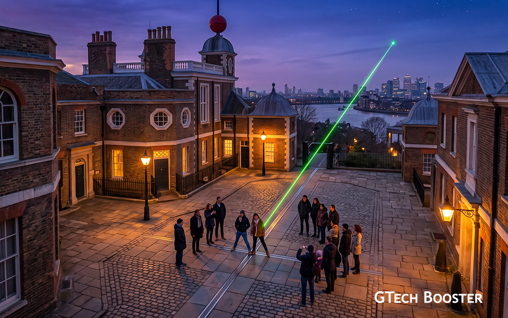
The Royal Observatory sits on a hill in Greenwich, and for many years visitors could stand astride a brass strip set into the courtyard, place one foot in the Eastern Hemisphere and one in the Western, and photograph the moment. The strip marked the Airy Transit Circle, the telescope around which the 1884 meridian was defined. Millions of tourists still do this.
Their phones disagree with them.
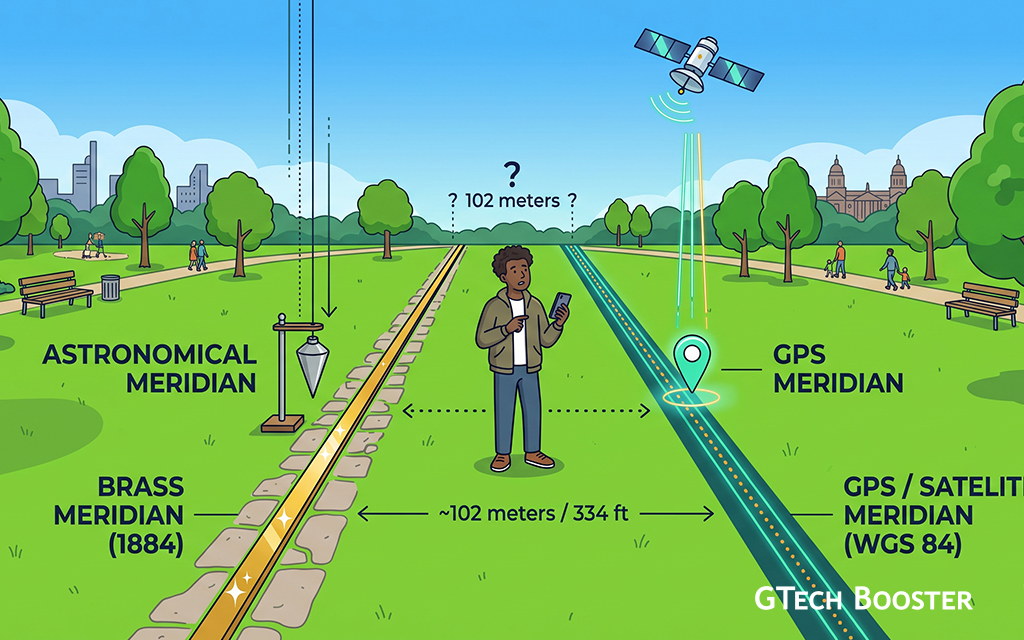
A GPS receiver standing at the Airy Transit Circle will show a longitude of approximately 0.0015 degrees east, not zero. The actual zero line of modern global positioning runs about 102 metres east of the historic brass strip. The physical line on the ground and the digital line used by every navigation system on earth do not coincide.
The reason is a subtle one, and it was only fully explained in 2015. The astronomers who defined the original meridian measured their vertical reference using a mercury basin, a technique that relied on local gravity. Gravity at any given point is not perfectly perpendicular to the earth’s rotational axis. It is deflected slightly by the distribution of mass in the surrounding terrain and geology. At Greenwich, this local deflection was small but measurable. When GPS and subsequent satellite systems defined their reference frame, they used models of the earth’s gravitational field constructed from observations across the whole planet, which smooth out local variations. The result was a zero meridian that is globally accurate but locally displaced from the line the nineteenth century astronomers marked.
The historic meridian and the functional meridian are not the same line. The tourist photograph and the satellite coordinate reference different things. Both are, in their own terms, correct.
180 Degrees Away: The Antimeridian
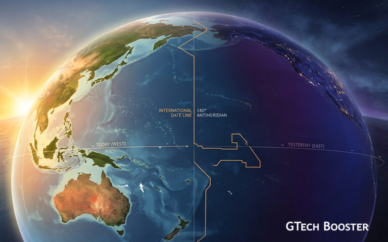
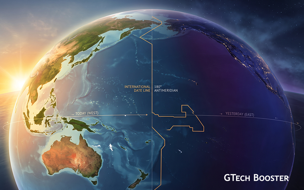
If the Prime Meridian is where longitude begins, the Antimeridian is where it ends. Running at 180 degrees, exactly opposite Greenwich, the Antimeridian passes through the Pacific Ocean and serves as the basis for the International Date Line.
The need for a date line flows directly from the logic of the Prime Meridian. If you travel eastward around the globe, each time zone you enter is one hour ahead. By the time you have completed a circuit of twenty-four zones, you have accumulated twenty-four hours. You are a full day ahead of where you started, which creates an arithmetic paradox: travellers who circle the globe are, by the book of time zones, arriving before they left. The date line resolves this by declaring a boundary. Cross it travelling west, and you add a day. Cross it travelling east, and you subtract one.
Jules Verne made elegant use of this logic in Around the World in Eighty Days, published in 1873, more than a decade before the 1884 conference formalised the system. His protagonist, Phileas Fogg, travels east from London, bets that he can circumnavigate the globe in eighty days, arrives home believing he has failed by a single day, and discovers he has gained a day by travelling continuously in the same direction as the sun. Verne had grasped the implication before the world’s governments had agreed on the mechanism to manage it.
Why the Date Line Bends
The Antimeridian at 180 degrees, if followed precisely, would cut through several island groups and landmasses, leaving parts of a single country on different calendar days. No government has ever agreed to manage that situation. The International Date Line therefore deviates from the 180-degree line in several places, following national borders rather than geometry.
Russia’s Chukotka Peninsula and Wrangel Island lie east of 180 degrees but observe the same date as the rest of Russia, placing the line around them to the east. Alaska’s Aleutian Islands, some of which extend past the 180th meridian, remain on the American side of the date line.
The most dramatic adjustment was made by Kiribati in 1995. The island nation had been bisected by the date line, with its western islands observing one date and its eastern islands, including the Line Islands, observing the day before. For administrative and commercial purposes this was chaotic. The government simply moved the date line eastward around its entire territory, making Kiribati, on its easternmost points, the first place on earth to greet any new day, and indeed the first place to have celebrated the year 2000.
Samoa and Tokelau made a comparable adjustment in 2011, switching from the eastern side of the date line to the western. Samoa’s government reasoned, practically, that its primary trading partners were Australia and New Zealand, not the United States. By losing a calendar day (the country deleted December 30 from its calendar entirely that year), it aligned itself commercially with the countries it actually did business with.
The Bering Strait offers the sharpest illustration of what the date line means at human scale. Big Diomede Island belongs to Russia. Little Diomede Island belongs to United States. The two islands are separated by approximately 3.8 kilometres of water. They lie on opposite sides of the International Date Line. At any given moment, Big Diomede is roughly twenty-one hours ahead of Little Diomede. Neighbours, close enough to see one another on a clear day, living in different tomorrows.
The Geometry of Agreement
The Prime Meridian, Greenwich Mean Time, and the Antimeridian are not discoveries. They are agreements. The earth has no natural seam at zero degrees longitude, no crease at 180. What these lines represent is a rare case of humanity accepting a convention for purely practical reasons, settling a dispute not through conquest or ideology but through a vote at a conference table in Washington, and then building a global system on the result.
That the French sulked for twenty-seven years before formally adopting the outcome, and that a GPS receiver will now disagree with a brass strip in a London courtyard, does not diminish the achievement. It makes it more recognisably human. A good enough agreement, adopted imperfectly, maintained imperfectly, and revised as instruments improve, has underpinned the navigation of ships and aircraft, the coordination of global commerce, and the synchronisation of communications networks for nearly a century and a half.
Every flight path, every shipping lane, every satellite orbit, every phone map and every clock on earth that shows a time zone offset is built on a vote taken in 1884. The world agreed to start counting from Greenwich. It has been doing so ever since.
More Information ℹ
















Conversation
Login to comment.
Log In / Register